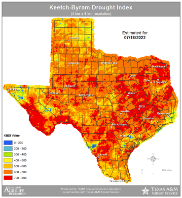
Wildfire conditions continue to worsen over the state
Body
An upper-level ridge of high pressure is building yet again over the southern plains, this time centered over OK and N TX where surface air temperatures will reach 108-113 degrees over the next few days. Locally SE TX is sitting at the base of the ridge and we will “only” see actual air temperatures in the low 100’s however heat index values will reach 107-112 during the afternoon hours which is good enough for another heat advisory that starts tomorrow and will likely last much of the week.