
Trough in the Gulf of Mexico
More rain expected along the lower coast
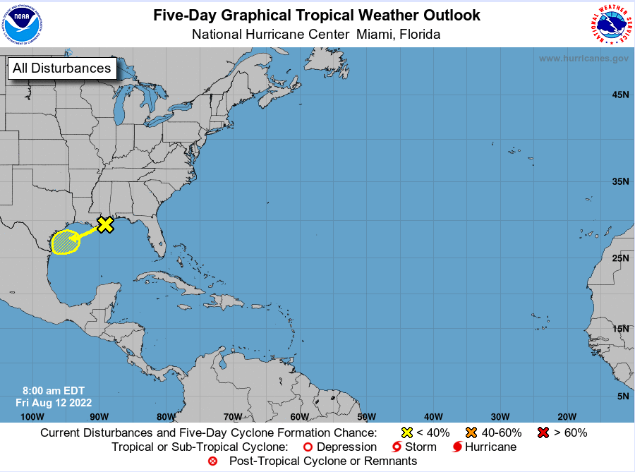
Trough axis and mid-level low pressure system over the northern Gulf of Mexico will drift westward over the weekend and into the lower TX coast.
Satellite images, coastal radars, and offshore buoys/oil platforms indicate an elongated trough axis that extends off the coast of TX ENE toward the MS/AL coast with scattered to numerous showers and thunderstorms along this boundary. This boundary can be traced back to the “front” that moved through the area with thunderstorms on Wednesday evening. A mid-level low pressure area is located over SE LA and is moving slowly westward.
Over the last few days, the ICON global model has been suggesting surface low pressure may begin to develop with the mid-level circulation as it moves westward over the weekend and several of the higher resolution models also show various degrees of surface low pressure formation very near the TX coast on Saturday. Overnight both the GFS and ECWMF models have also trended toward some slight formation of lowering pressures along the TX coast this weekend. While the upper-level winds are favorable for development near the TX coast, it is most likely that the mid-level low will not have enough time to work down toward the surface before moving inland late Saturday into Sunday between Brownsville and Corpus Christi.
The National Hurricane Center is indicating a 10% chance of development over the weekend.
With the mid/low level circulation expected to move W/WSW over the NW Gulf this weekend, it is expected that much of the shower and thunderstorm development will focus near the coast and offshore and this has been suggested by the high-resolution models for the last 24 hours. With that said, areas south of I-10 will be well within the deep moisture envelope of the circulation and bands of showers and thunderstorms will be possible at nearly any time over the next 48-72 hours.
The greatest chances will be near the coast with lesser chances inland to the north as high pressure and drier air begins to build southward from the northeast. Given PWS of 2.2-2.3 inches and possible cell training a quick 2-3 inches of rainfall in less than an hour will be possible, so while grounds are dry and mostly will be able to handle the rainfall, some street flooding will be possible with those rates.
Tides are already elevated along the coast due to the full moon, but have been coming in below advisory levels at high tide over the last few days. Easterly and southeasterly low-level winds on the north side of the surface trough/low may bump seas up a bit over the weekend and push tides a little higher. Still think we will stay below advisory levels, but water will be way up the beaches at high tides over the weekend.