Rain Chances
Body
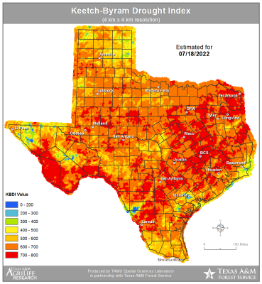
Upper level ridge of high pressure currently located over the SW US will back westward slightly today and weaken on the eastern flank. This will allow a trough over the southern US to move westward a bit. Local radars over LA this morning show a complex of thunderstorms east of the central LA area moving westward and convection allowing models (CAMs) are in general agreement that this complex and its associated outflow boundary will continue westward toward the Sabine River today and then into east Texas this afternoon and toward the I-45 corridor by mid to late afternoon.